ページ-分類-番号 表題 (p3-図版-No.1は原本3ページの図版-番号No.1を表す)
p1- 扉-No.00 ATLAS OF PANORAMAS AND VIEWS, WITH GEOGRAPHICAL, AND GEOLOGICAL MAPS.
p2-献辞-No.001 TO HER MAJESTY VICTORIA
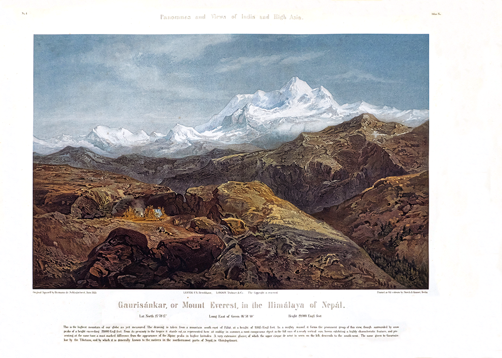
p3-図版- No.1Gaurisánkar, or Mount Everest, in the Himálaya of Nepál.
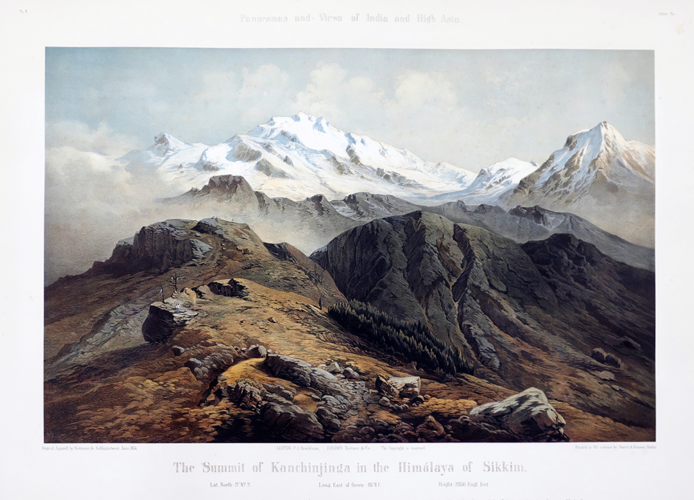
p4-図版-No.2The Summit of Kanchinjinga in the Himálaya of Sikkim.
p5-図版-No.3 The Sátlej Valley and the Environs of Rámpur in the Western Himálaya.
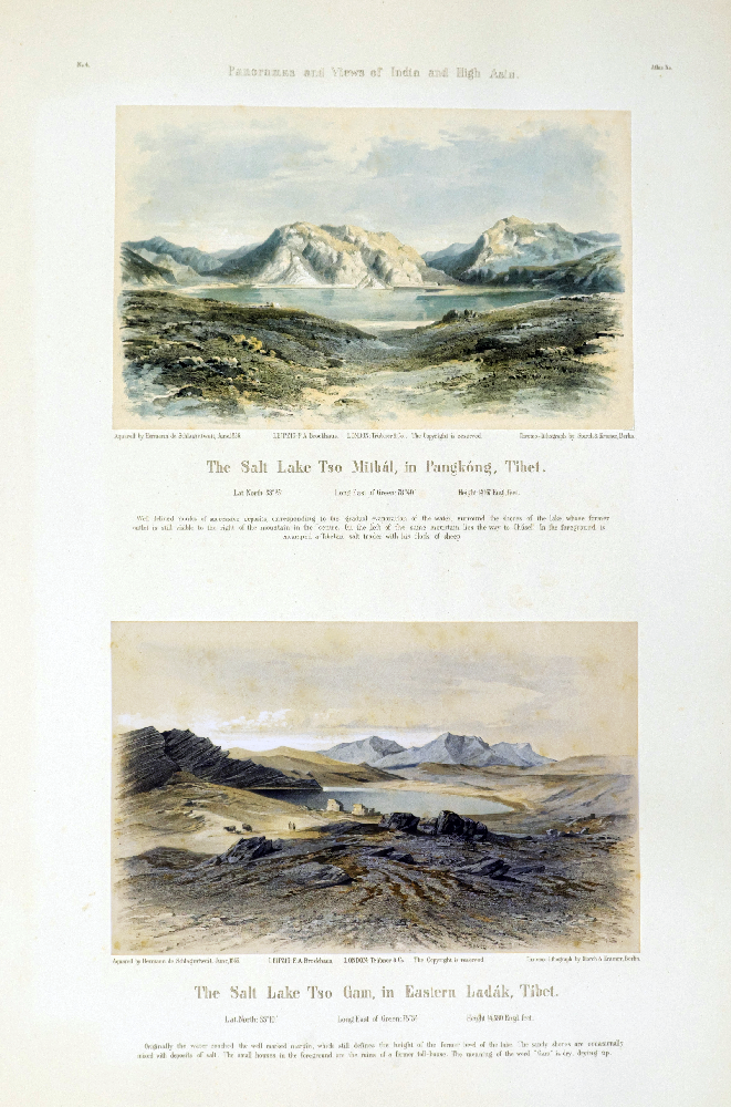
p6-図版-No.4上 The Salt Lake Tso Mitbál, in Pangkóng, Tibet.
-No.4下 The Salt Lake Tso Gam, in Eastern Ladák, Tibet.
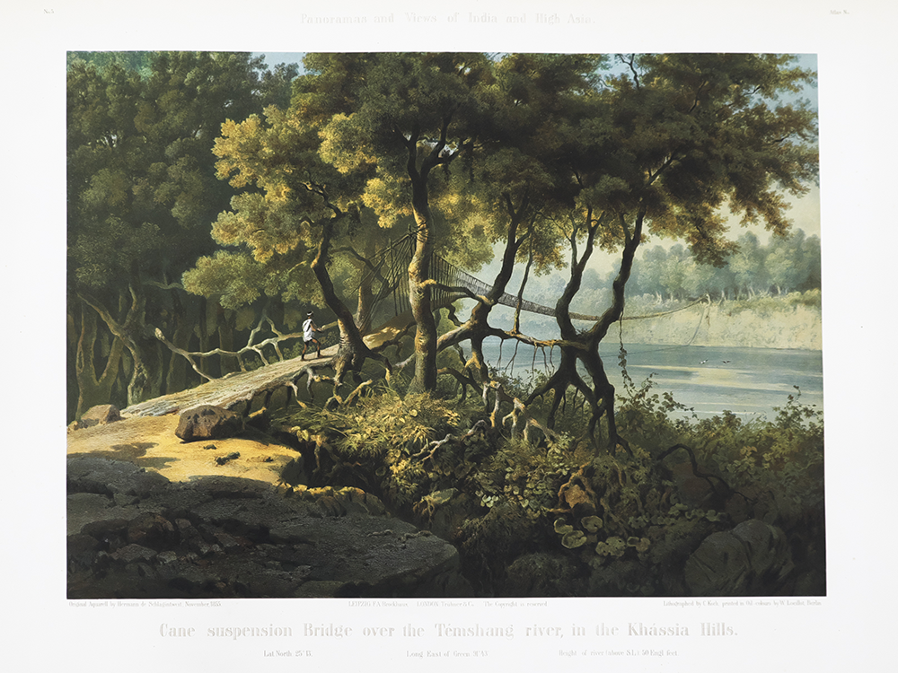
p7-図版-No.5 Cane suspension Bridge over the Témshang river, in the Khássia, Hills.
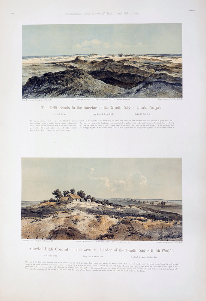
p8-図版-No.6上 The Drift Sands in the Interior of the Sindh Ságer Duáb, Pánjáb.
-No.6下 Alluvial High Ground on the western border of the Sindh Ságer Duáb, Panjáb.
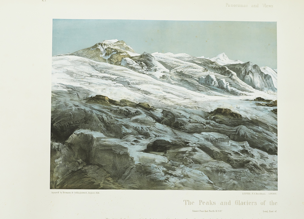
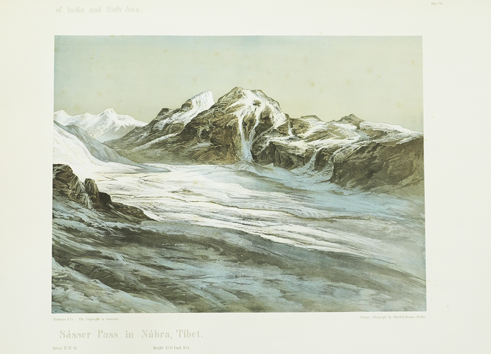
p9-図版-No.7 The Peaks and Glaciers of the Sásser Pass in Núbra, Tibet.
p10-図版- No.7-2 The Peaks and Glaciers of the Sásser Pass in Núbra, Tibet.
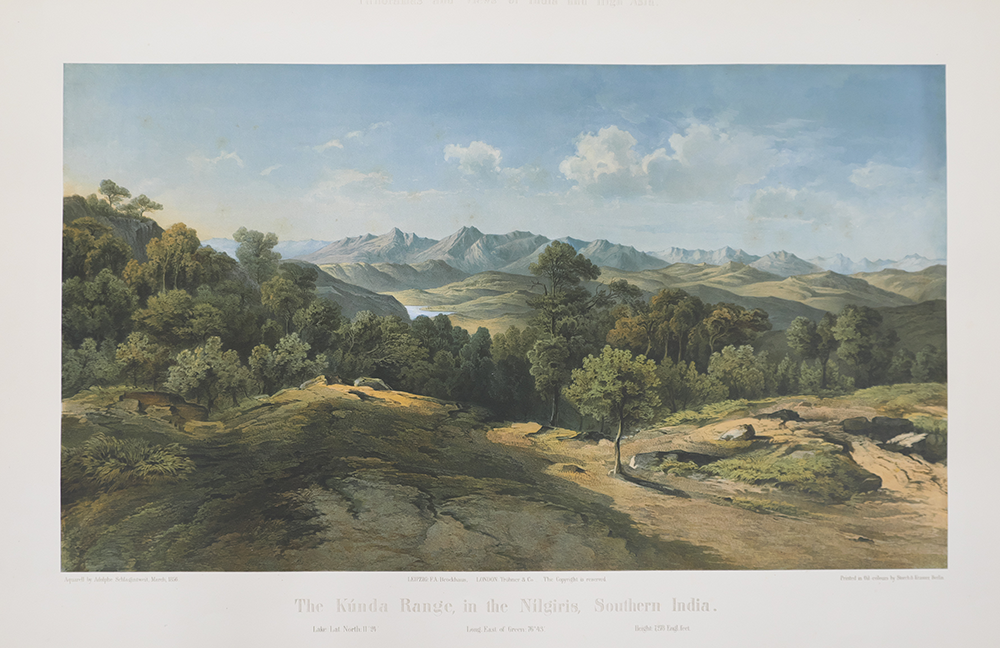
p11-図版-No.8 The Kúnda Range in the Nilgiris, Southern India.
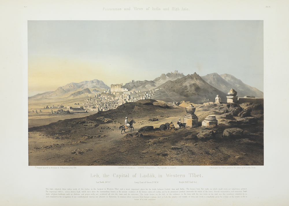
p12-図版-No.9 Leh, the Capital of Ladák, in Western Tibet.
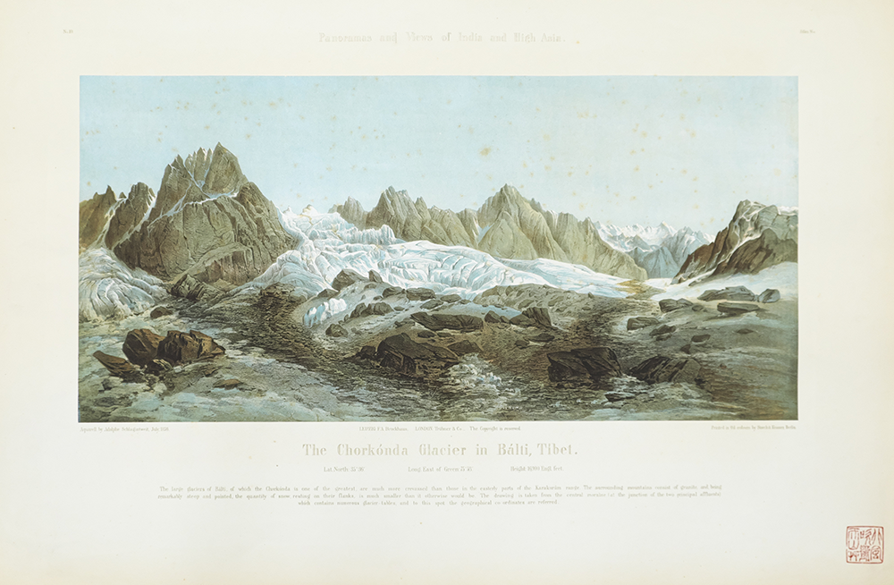
p13-図版-No.10 The Chorkónda Glacier in Bálti, Tibet.
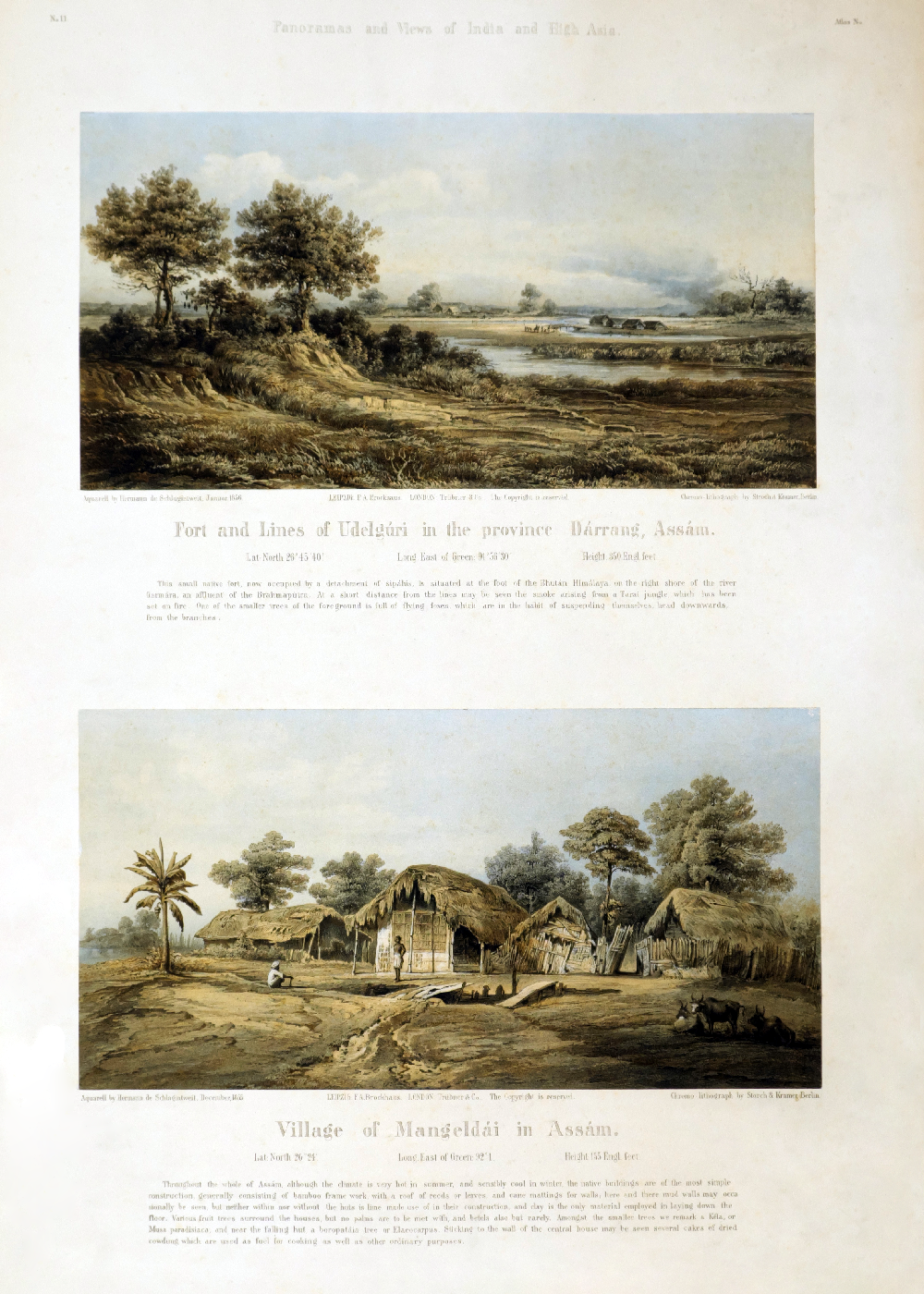
p14-図版-No.11上 Fort and Lines of Udelgúri in the province Dárrang, Assám.
-No.11下 Village of Mangeldái in Assám.
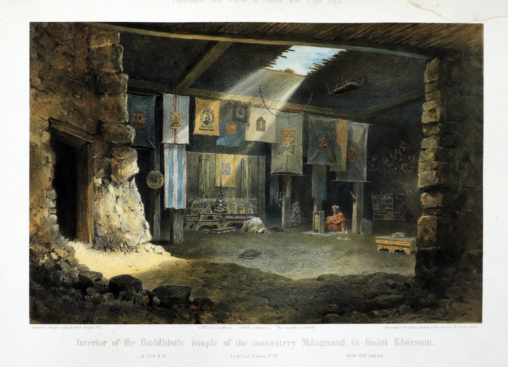
p15-図版- No.12 Interior of the Buddhistic temple of the monastery Mángnang, in Gnári Khórsum.
p16-図版- No.13 The Salt Lake Kiúk Kiol, in the Karakásh valley, Turkistán.
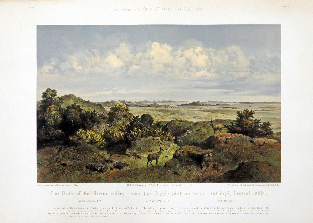
p17-図版-N0.14 The flats of the Hiron valley from the Barér plateu near Kattingi, Central India.
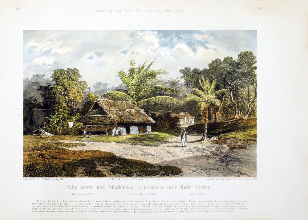
p18-図版-No.15 Palm grove and Singhalése habitations near Gálle, Ceylon.
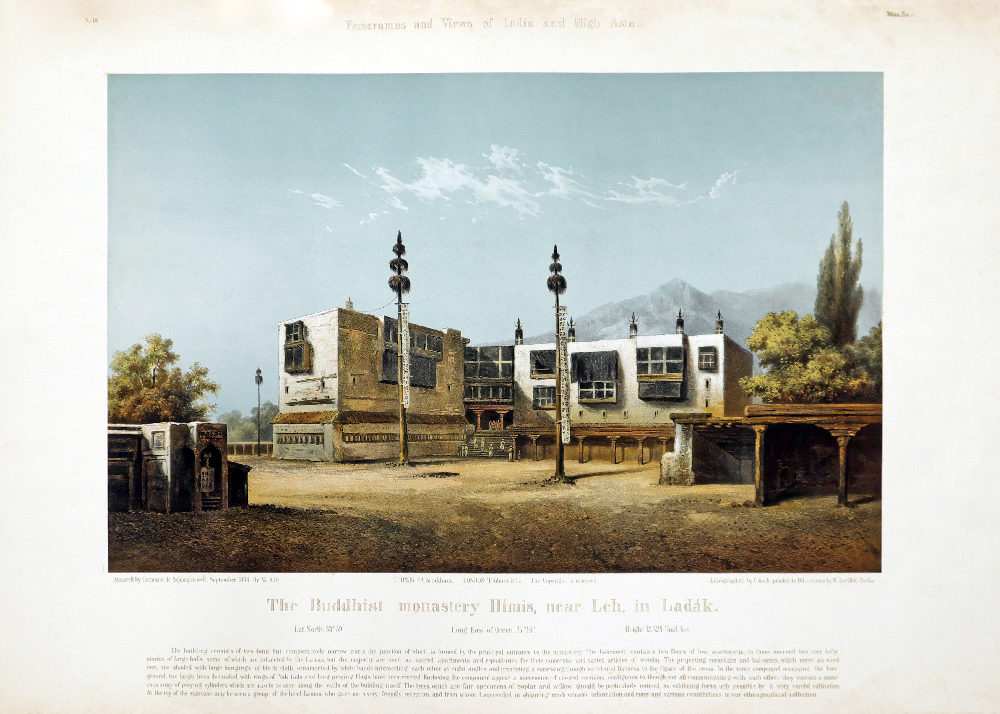
p19-図版-No.16 The Buddhist monastery Himis, near Leh, in Ladák.
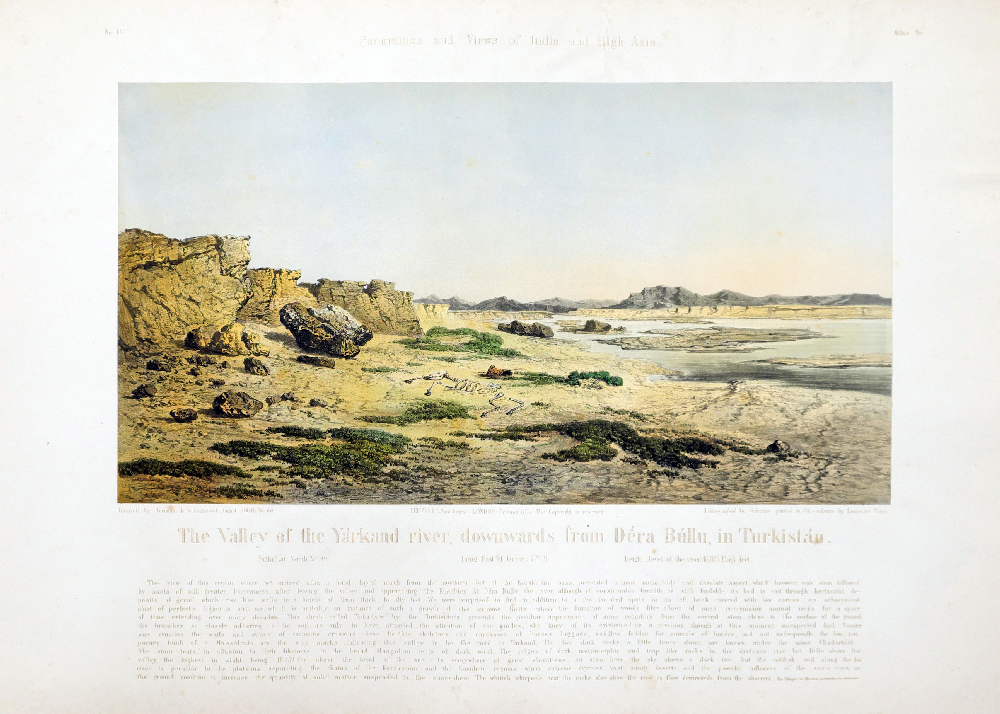
p20-図版-No.17 The Valley of the Yárkand river, downwards from Déra Búllu, in Turkistán.
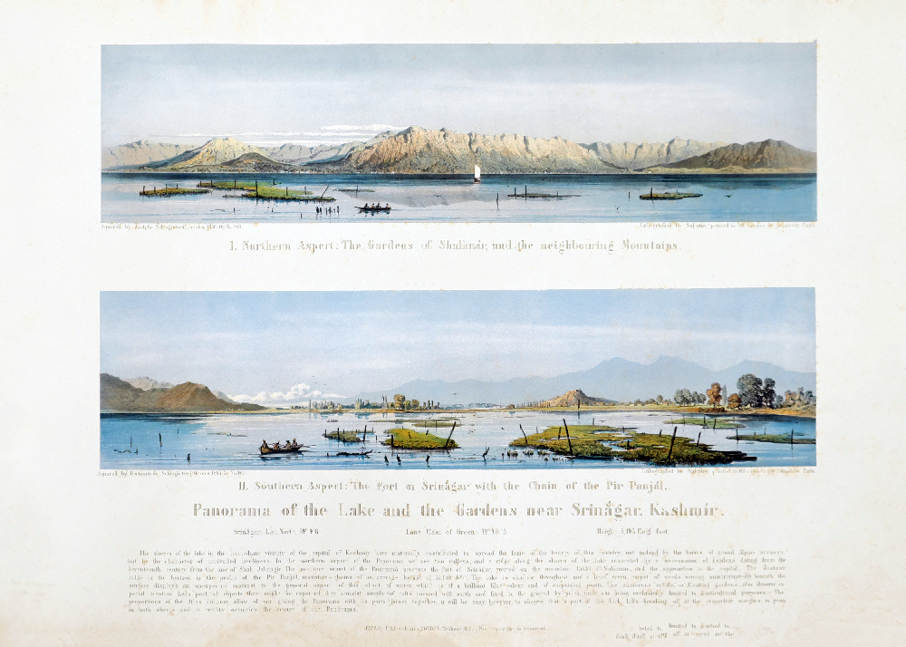
p21-図版-No.18 Panorama of the Lake and the Gardens near Srinágar, Kashmir.
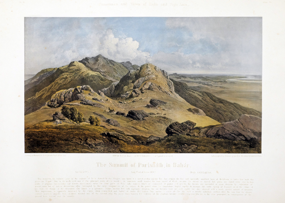
p22-図版-No.19 The Summit of Parisnáth, in Bahár.
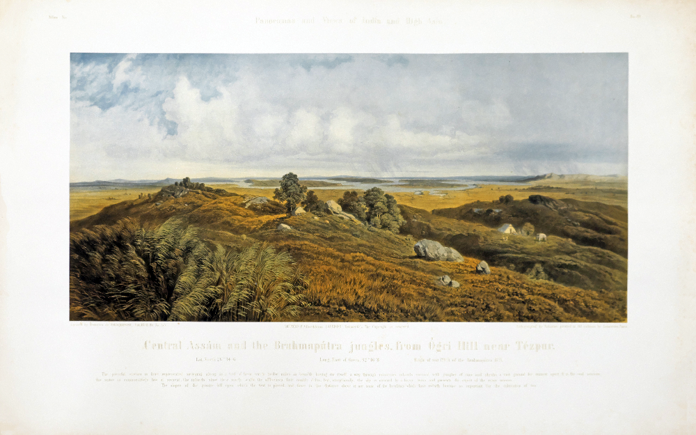
p23-図版-No.20 Central Assám and the Brahmapútra jungles, from Ógri Hill near Tézpur.
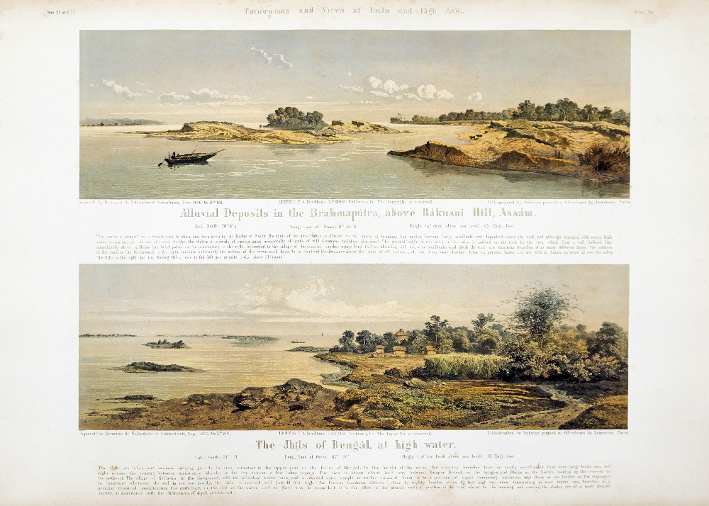
p24-図版上-No.21 Alluvial Deposits in the Brahmapútra, above Rákusni Hill, Assám.
下 -No.22 The Jhils of Bengál, at high water.
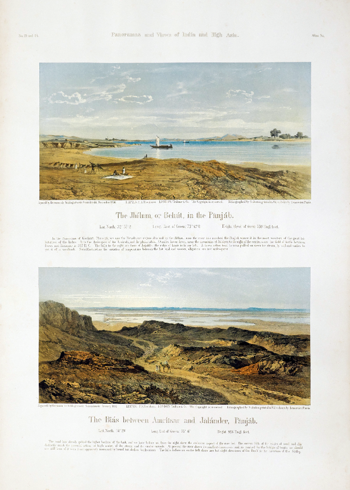
p25-図版上-No.23 The Jhilum, or Behút, in the Panjáb.
下-No.24 The Biás between Amritsar and Jalánder, Panjáb.
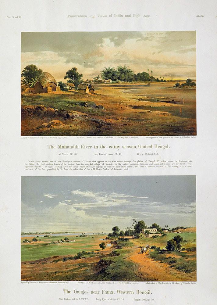
p26-図版上-No.25 The Mahanádi River in the rainy season, Central Bengál.
下-No.26 The Ganges near Pátna, Western Bengál.
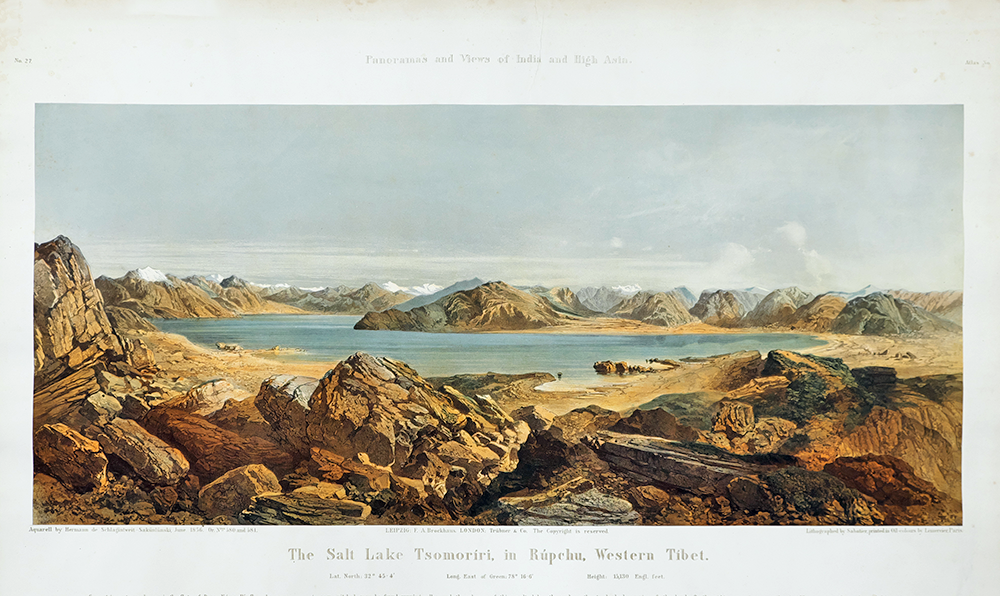
p27-図版-No.27 The Salt Lake Tsomorriri, in Rúpchu, Western Tibet.
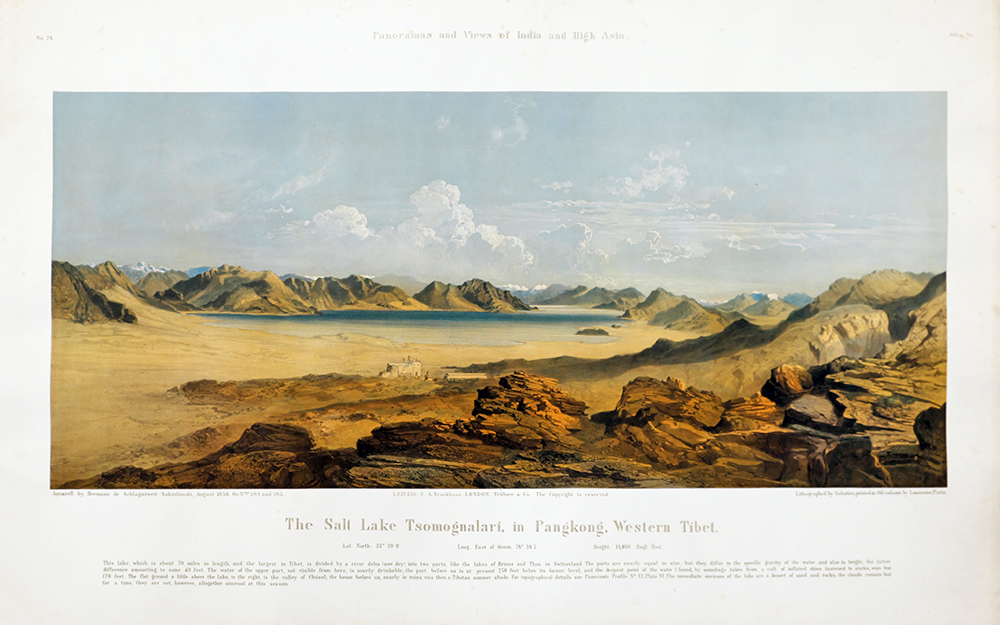
p28-図版-No.28 The Salt Lake Tsomognalari, in Pangkong, Western Tibet.
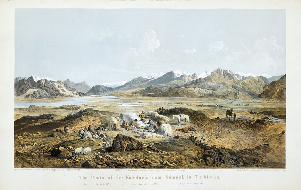
p29-図版-No.29 The Chain of the Kuenlúen, from Súmgal, in Turkistán.
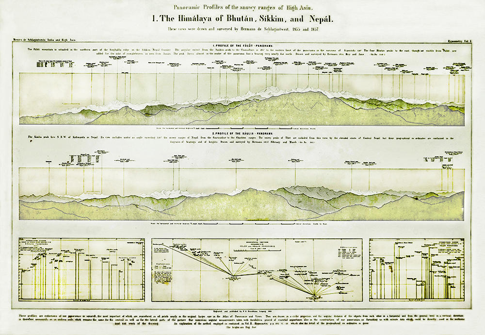
p30-パノラマ- Ⅰ.The Himálaya of Bhután, Sikkim, and Nepál.
p31-パノラマ- Ⅱ.The Himálaya of Kámáon and Gárhvál.
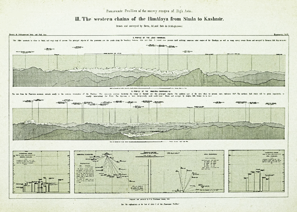
p32-パノラマ-Ⅲ.The western chains of the Himálaya from Simla to Kashmir.
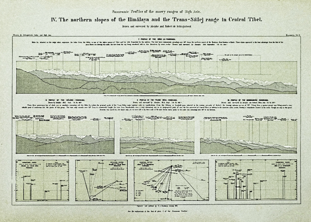
p33-パノラマ-Ⅳ.The northern slopes of the Himálaya and the Trans-Sátlej range in Central Tibet.
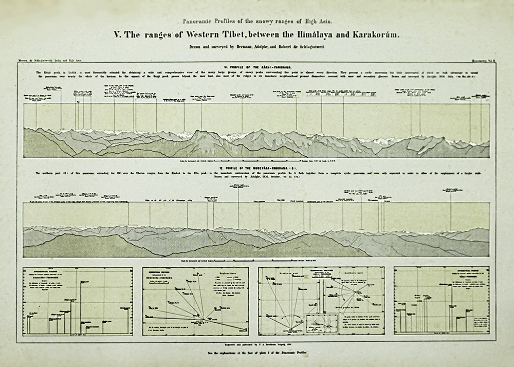
p34-パノラマ-Ⅴ.The ranges of Western Tibet, between the Himálaya and Karakorúm.
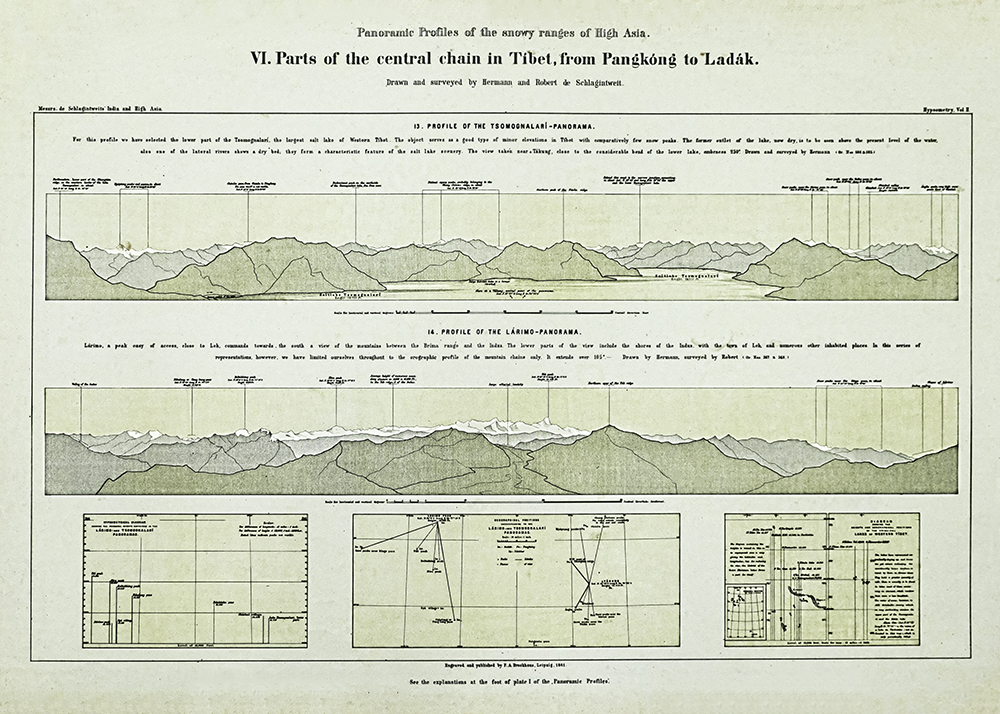
p35-パノラマ-Ⅵ.Parts of the central chain in Tibet, from Pangkóng to Ladák.
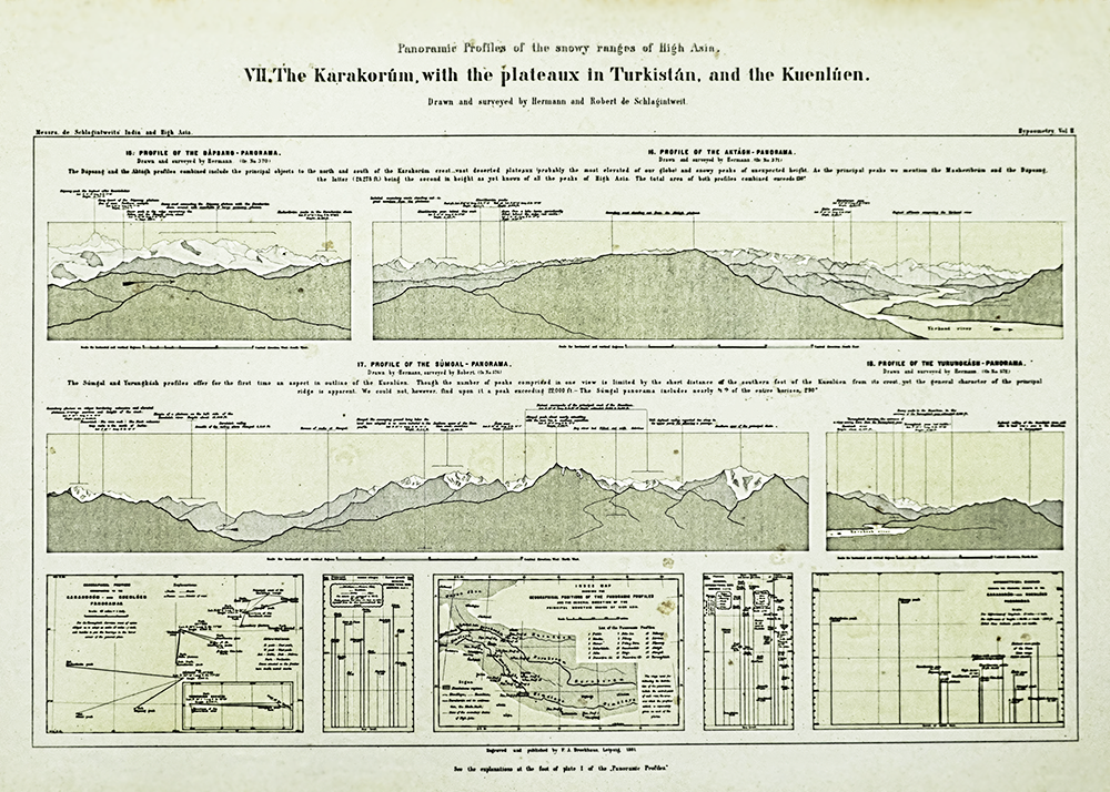
p36-パノラマ-Ⅶ.The Karakorúm, with the plateaux in Turkistán, and the Kuenlúen.
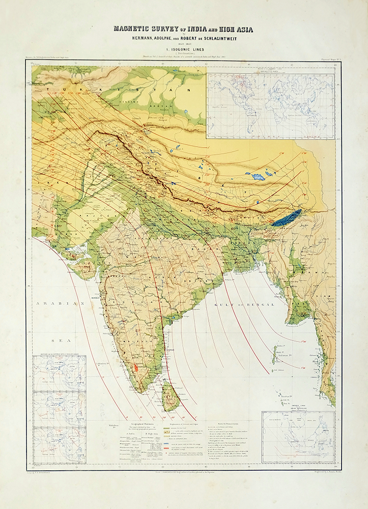
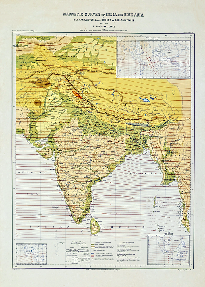
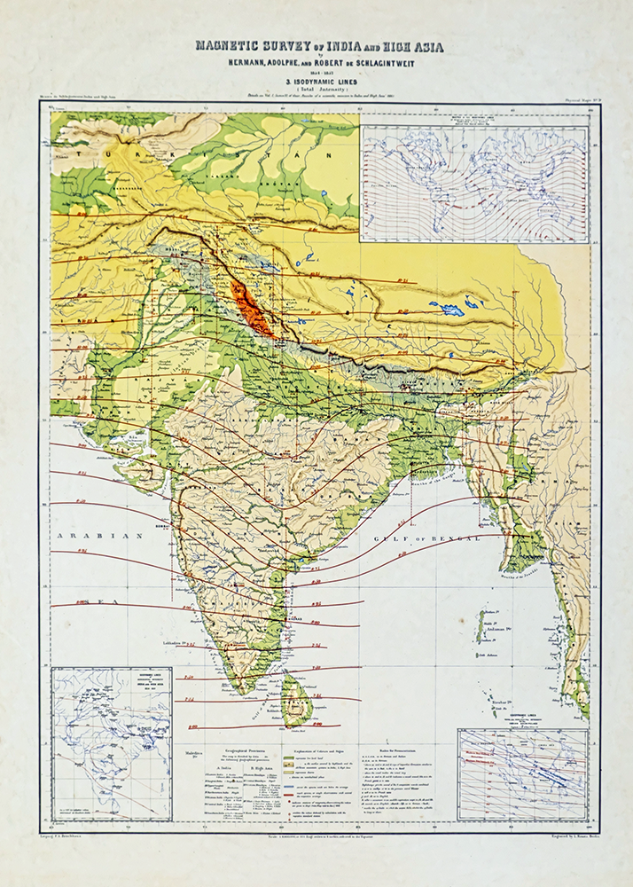
p37-地図 -1.MAGNETIC SURVEY of INDIA and HIGH ASIA 1. ISOGONIC LINES
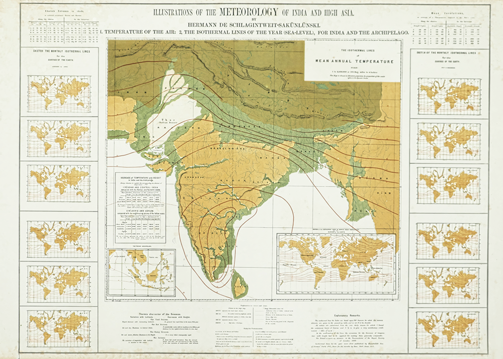
p41-イラスト 表 ILLUSTRATIONS OF THE METEOROLOGY OF INDIA AND HIGH ASIA.
p42-イラスト ILLUSTRATIONS OF THE METEOROLOGY OF INDIA AND HIGH ASIA.
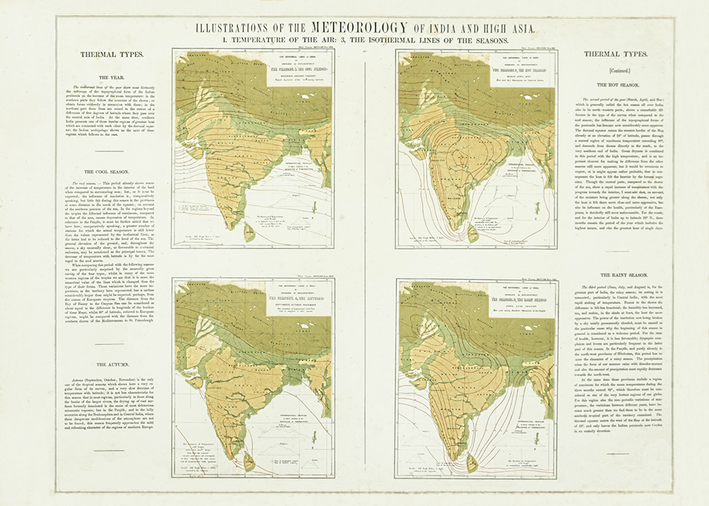
p43-イラスト ILLUSTRATIONS OF THE METEOROLOGY OF INDIA AND HIGH ASIA.
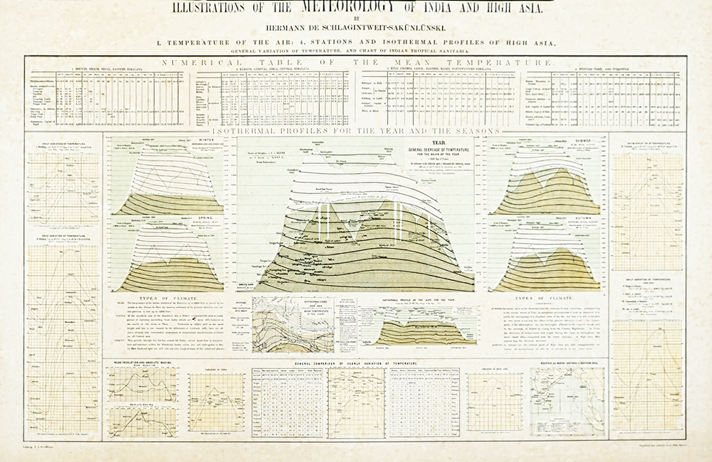
p44-イラスト ILLUSTRATIONS OF THE METEOROLOGY OF INDIA AND HIGH ASIA.
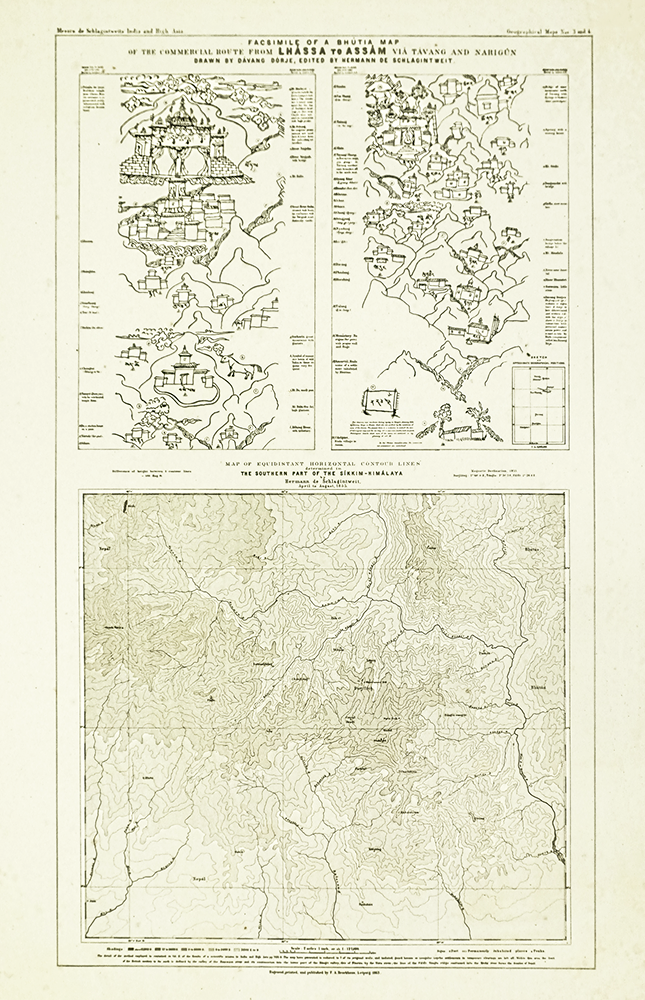
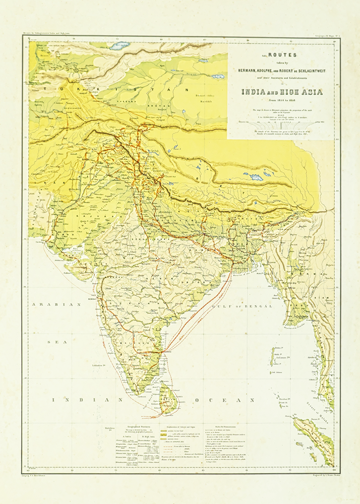
p45-地図 ROUTES INDIA and HIGH ASIA
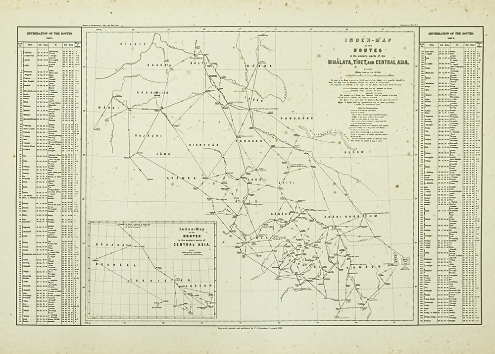
p46-イラスト INDEX-MAP ROUTES in the western part of the HIMÁLAYA, TIBET, and CENTRAL ASIA.
